Mini Moss Relay Course Overview
Everything you could want to know is in this Mini Moss Team Guide (PDF)
Paved legs follow the Olympic Discovery Trail, a multiuse path for runners, cyclists, walkers, and horseback riders. Relatively flat and fast, though you will encounter some rolling hills. Most of the ODT is separate from traffic, but it does share the shoulder with traffic in a few places. We’ve noted traffic situations in the descriptions below.
How hard is this thing? We’ve omitted difficulty ratings because (a) what’s easy for you might be agony for your teammate, and (b) the Mini Moss Relay course is pretty darn runner-friendly. Challenges arise with the leg distances, hilly trail legs, and the potential for all sorts of weather in the many microclimates along the way. (Also your stinky friends in your team van.)
Our advice: Check out the course guide and assign legs accordingly. (And bring big Ziplocs for your stinky running gear.)
Waves will be assigned based on your estimated average team pace as indicated on your registration. Please be as accurate as possible on your pace estimates. Do NOT pad your time because you are worried about making the cutoffs. If you run faster than your average pace and beat the exchange zone volunteers, your team will be held and made to wait. You do not have anything to gain by padding your average pace! Don’t worry! We will be sure to assign you a start time that will allow you to make the check points based on your ACTUAL average pace. We will assign wave start times in early January for your planning purposes, but in general the waves will be structured as follows:
Mini Moss Relay Start Times:
Wave 1 (11-12 minute mile pace): 1:00 p.m. start. Check-in start at 12:00 p.m.
Wave 2 (9-11 minute mile pace): 2:00 p.m. start. Check-in start at 1:00 p.m.
Wave 3 (7-8 minute mile pace): 2:30 p.m. start. Check-in start at 1:30 p.m.
DAWDLERS BEWARE! Teams must average a 12 minute pace or faster, including time spent at exchanges. Please take note of the cut off times.
ROADS ARE OPEN: Traffic rules apply. Runners and team vans must use caution at all crossings, along shared roadways, and exchange points.
Bookmark the Mini Moss Relay routes on MapMyRun.
Distances are rounded to the nearest tenth or quarter mile. Click images and maps to enlarge.
Leg 1: West Port Angeles
Distance: 3.75 miles
Elevation Gain: 116 feet
Surface: Paved ODT, neighborhood streets, sidewalk.
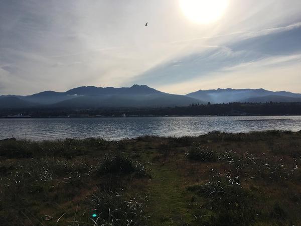
Highlights: Follow the paved path from the end of Ediz Hook, a 3-mile long sand spit into downtown Port Angeles. Big view of the Olympic Mountains and inner Port Angeles harbor lead you to the relay exchange at Field Arts & Events Hall.
Traffic Alert: Mix of shoulder, sidewalk, and ODT. Watch for course markings.
View Leg 1 at MapMyRun
Driving Directions to next exchange

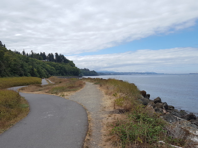
Leg 2: Port Angeles Waterfront
Distance: 5.25 miles
Elevation Gain: 460 feet
Surface: Paved ODT.
Highlights: Pure Strait of Juan de Fuca goodness. Watch for river otters! Save some energy for the climb at the end!
Traffic Alert: Watch for traffic at the street crossing after the Morse Creek trestle.
View Leg 2 at MapMyRun
Driving Directions to next exchange

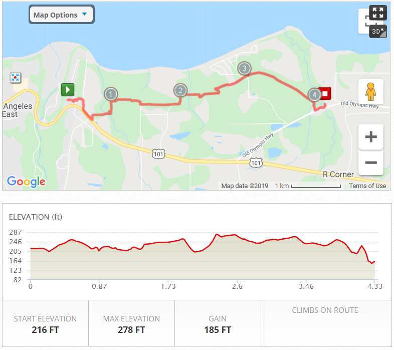
Leg 3: Deer Park to Old Olympic
Distance: 4.3 miles
Elevation Gain: 185 feet
Surface: Paved ODT
Highlights: In a little bit you will get back away from the highway, and you do so via a big down and up at a covered bridge over Bagley Creek. But after that it’s lovely rolling hills through the trees all the way to Old Olympic Hwy at Siebert Creek.
View Leg 3 at MapMyRun
Driving Directions to next exchange
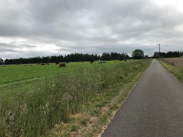
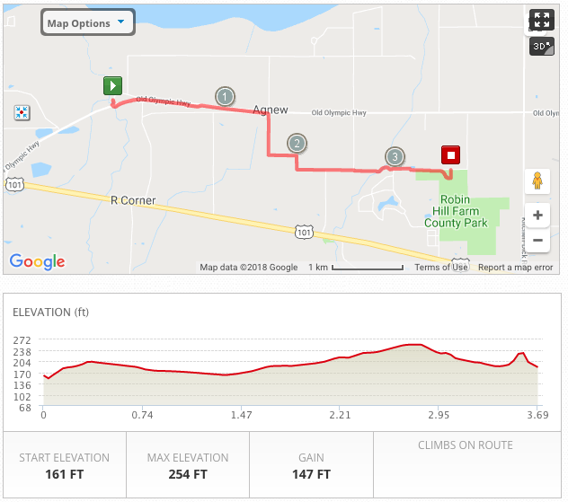
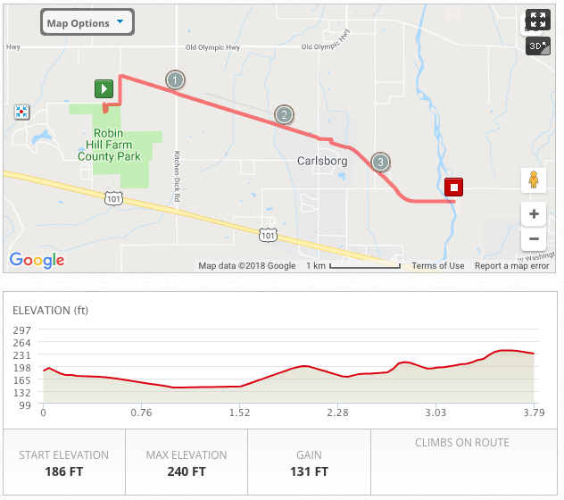
Leg 4: Robin Hill Country Park
Distance: 3.7 miles
Elevation Gain: 147 feet
Surface: Paved ODT.
Highlights: Make up for lost time entering the flatlands of Sequim. Forest gives way to working farmland. Say hello to the cows. It’s usually warmer and drier out this way, too. Welcome to the rainshadow.
View Leg 4 at MapMyRun
Driving Directions to next exchange
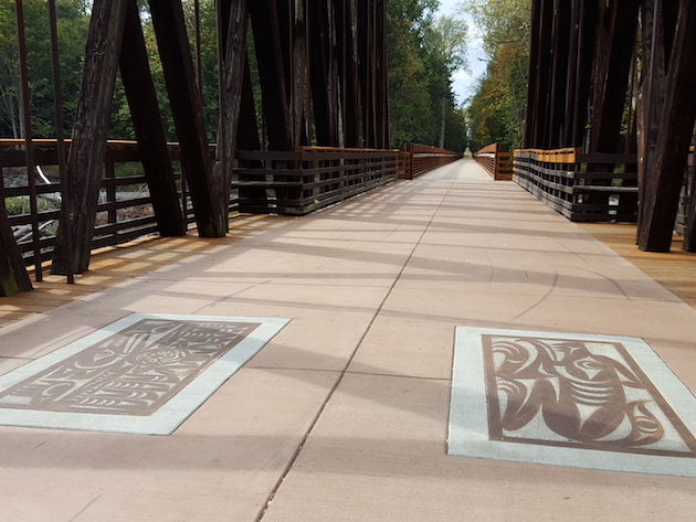
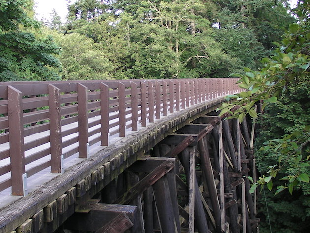
Leg 5: Dungeness River Railroad Bridge 6:30pm CUTOFF
Distance: 3.8 miles
Elevation Gain: 131 feet
Surface: Paved ODT.
Highlights: In February 2015, a high-water event washed away the Dungeness River trestle. Thanks to the Jamestown S’Klallam Tribe, volunteers with the Peninsula Trails Coalition, and many others, the rebuilt trestle at the end of Leg 12 was ready for action just a year later. Check out the beautiful S’Klallam artwork embedded on the walkway
Cutoff Alert: Teams finishing this leg after 6:30pm MUST skip a leg and continue on (but will receive a DNF, no finish time), OR you can opt to go directly to the finish line party.
View Leg 5 at MapMyRun
Driving Directions to next exchange

Leg 6: City of Sequim
Distance: 4.25 miles
Elevation Gain: 50 feet
Surface: Paved ODT, city sidewalks.
Highlights: A quick jaunt through Sequim (pronounced “Squim”), home to the annual Lavender Festival, Olympic Birdfest, and a retiree mecca, thanks to its location in the rainshadow and its walk/bike-friendly streets.
Traffic Alert: Lots of street crossings. Watch for course markings.
View Leg 6 at MapMyRun
Driving Directions to next exchange

Leg 7: Sequim East. Almost There!
Distance: 2.91 miles
Elevation Gain: 125 feet
Surface: Paved ODT, city sidewalks.
Highlights: Begin at Sequim Chamber of Commerce. If you’re lucky (and if it’s still light out), the local elk herd will make an appearance along this stretch. Terrain gets a little rolly and the tall trees reappear as you head toward Blyn.
Traffic Alert: End of this leg/beginning of next is at a road crossing.
View Leg 7 at MapMyRun
Driving Directions to next exchange


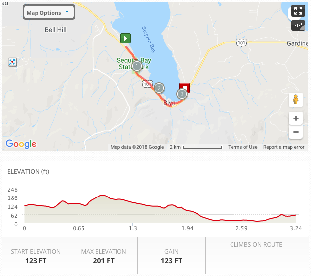
Leg 8: Finish Line in Blyn!
Distance: 3.25 miles
Elevation Gain: 123 feet
Surface: Paved ODT.
Highlights: Last leg! Recap the day with tall evergreens, another restored railroad trestle, a dash through Sequim Bay State Park, open prairie, a lovely net downhill grade, and the finish line after-party in Blyn at the Jamestown S’Klallam Tribe facilities! Way to go, Frosty Mossers! You did it!
View Leg 8 at MapMyRun
Driving Directions to next exchange